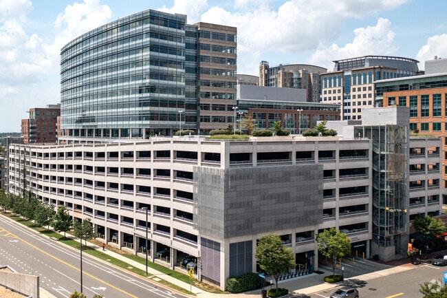
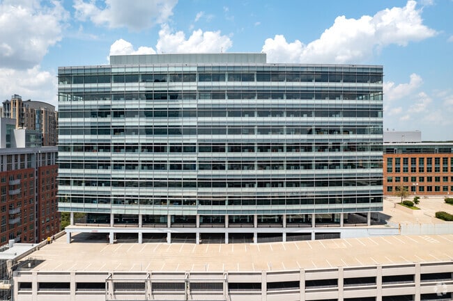
Property Record
1885 Explorer St, Reston, VA 20190

Current Lease Availabilities
NEARBY LISTINGS FOR SALE OR LEASE
Property Detail
1885 Explorer St
Washington-Arlington-Alexandria, DC-VA-MD-WV
Reston
0173-10-0015
RESTON BLK 15 SEC 91A
Officebuilding
Fairfax
X
Virginia
51059C0130E
15
2024
2.34 AC
2025
Reston
482201
Washington, DC
263,767 SF
DEMOGRAPHICS near 1885 Explorer St
1 Mile
3 Mile
5 Mile
2024 Total Population
16,550
127,289
226,861
2029 Population
16,612
126,034
227,319
Pop Growth 2024-2029
+ 0.37%
(0.99%)
+ 0.20%
Average Age
41
39
39
2024 Total Households
8,925
50,094
82,782
HH Growth 2024-2029
+ 0.35%
(0.84%)
+ 0.16%
Median Household Inc
$127,620
$134,660
$144,509
Avg Household Size
1.80
2.50
2.70
2024 Avg HH Vehicles
1.00
2.00
2.00
Median Home Value
$598,774
$637,743
$685,842
Median Year Built
1999
1985
1986
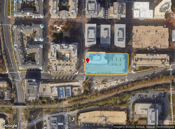
Nearby Places
Map Layers
Map Styles
 Street
 Aerial
- Restaurants
- Banks
- Shops
- Fitness
- Groceries
PUBLIC TRANSPORTATION
TRANSIT/SUBWAY
Reston Town Center, Silver Line Center Platform (Metrorail Silver Line - WMATA)
DRIVE
WALK
Distance
Reston Town Center, Silver Line Center Platform (Metrorail Silver Line - WMATA)
10 min
0.5 mi
AIRPORT
Washington Dulles International
DRIVE
WALK
Distance
Washington Dulles International
15 min
6.9 mi
Ronald Reagan Washington Ntl
DRIVE
WALK
Distance
Ronald Reagan Washington Ntl
37 min
24.0 mi
Freight Ports
Port of Baltimore
DRIVE
WALK
Distance
Port of Baltimore
77 min
56.0 mi
Nearby Properties
Address
Land Use
TOTAL SIZE
Lot Size
Zoning
Address
Land Use
TOTAL SIZE
Lot Size
Zoning
6.67 AC
400
Address
Land Use
TOTAL SIZE
Lot Size
Zoning
1,071,881 SF
373
Address
Land Use
TOTAL SIZE
Lot Size
Zoning
643,232 SF
2.81 AC
373
Address
Land Use
TOTAL SIZE
Lot Size
Zoning
473,458 SF
13.74 AC
540
Address
Land Use
TOTAL SIZE
Lot Size
Zoning
1,096,572 SF
85.06 AC
110
Address
Land Use
TOTAL SIZE
Lot Size
Zoning
446,810 SF
1.12 AC
373
Address
Land Use
TOTAL SIZE
Lot Size
Zoning
450,397 SF
1.07 AC
373
Address
Land Use
TOTAL SIZE
Lot Size
Zoning
275,809 SF
0.75 AC
373
Address
Land Use
TOTAL SIZE
Lot Size
Zoning
332,957 SF
12.68 AC
550
Address
Land Use
TOTAL SIZE
Lot Size
Zoning
532,480 SF
4.62 AC
373
Address
Land Use
TOTAL SIZE
Lot Size
Zoning
469,276 SF
11.42 AC
373
Address
Land Use
TOTAL SIZE
Lot Size
Zoning
498,299 SF
7.40 AC
400
Address
Land Use
TOTAL SIZE
Lot Size
Zoning
560,356 SF
4.33 AC
372
Address
Land Use
TOTAL SIZE
Lot Size
Zoning
407,812 SF
33.12 AC
373
Address
Land Use
TOTAL SIZE
Lot Size
Zoning
429,038 SF
11.41 AC
400
Address
Land Use
TOTAL SIZE
Lot Size
Zoning
337,921 SF
13.57 AC
373
Address
Land Use
TOTAL SIZE
Lot Size
Zoning
437,235 SF
3.33 AC
373
Address
Land Use
TOTAL SIZE
Lot Size
Zoning
396,112 SF
15.92 AC
330
Address
Land Use
TOTAL SIZE
Lot Size
Zoning
490,340 SF
18.30 AC
320
Address
Land Use
TOTAL SIZE
Lot Size
Zoning
264,888 SF
8.59 AC
596
Address
Land Use
TOTAL SIZE
Lot Size
Zoning
411,519 SF
3.48 AC
350
Address
Land Use
TOTAL SIZE
Lot Size
Zoning
491,841 SF
19.21 AC
320
Address
Land Use
TOTAL SIZE
Lot Size
Zoning
519,708 SF
18.73 AC
316
Address
Land Use
TOTAL SIZE
Lot Size
Zoning
408,315 SF
5.06 AC
400
Address
Land Use
TOTAL SIZE
Lot Size
Zoning
394,900 SF
5.30 AC
373
Address
Land Use
TOTAL SIZE
Lot Size
Zoning
492,219 SF
16.89 AC
330
Address
Land Use
TOTAL SIZE
Lot Size
Zoning
322,205 SF
6.91 AC
330
The World's #1 Commercial Real Estate Marketplace
Connect with us
© 2026 CoStar Group
The information above has been obtained from sources believed reliable. While we do not doubt its accuracy we have not verified it and make no guarantee, warranty or representation about it. It is your responsibility to independently confirm its accuracy and completeness. Any projections, opinions, assumptions, or estimates used are for example only and do not represent the current or future performance of the property. The value of this transaction to you depends on tax and other factors which should be evaluated by your tax, financial, and legal advisors. You and your advisors should conduct a careful, independent investigation of the property to determine to your satisfaction the suitability of the property for your needs.